Cherry blossom
Evening Ride
- Distance: 12.1 mi
- Elevation gain: 535 ft
- Maximum elevation: 148 ft
- Elevation loss: 541 ft
- Minimum elevation: 46 ft
- Moving time: 1 h 26 m
- Moving speed: 8.4 mph
- Maximum speed: 22.5 mph
- Total time: 1 h 36 m
- Global speed: 7.6 mph
- Date: 04/20/2024
Interactive map
GPS track profile
About this GPS track
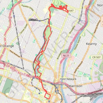
Name: Cherry blossom GPS track, route, trail
Coordinates: 40.73966 -74.18447 40.78904 -74.16082
Topography: Newark topographic map
Other GPS tracks
Click on a GPS track to view route, its statistics and profile.
Afternoon Ride
United States > New Jersey > Essex County > Newark
Distance: 13.0 mi • Elevation gain: 650 ft • Maximum elevation: 177 ft