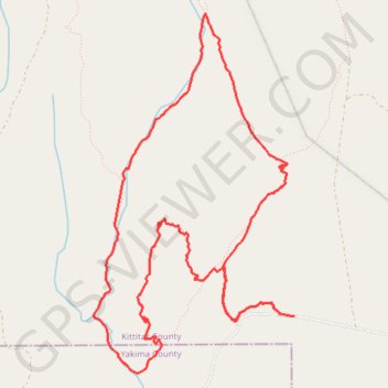
Loop bike in Wenas Wildlife Area
- Distance: 6.4 mi
- Elevation gain: 623 ft
- Maximum elevation: 3,091 ft
- Elevation loss: 614 ft
- Minimum elevation: 2,697 ft
- Moving time: 1 h 6 m
- Moving speed: 5.8 mph
- Maximum speed: 18.1 mph
- Total time: 2 h 4 m
- Global speed: 3.1 mph
- Date: 04/10/2024
Interactive map
GPS track profile
About this GPS track
Name: Loop bike in Wenas Wildlife Area GPS track, route, trail
Start: 13879, Umtanum Road, Kittitas County, Washington, 98926, United States (46.91406 -120.63625)
End: 13754, Umtanum Road, Kittitas County, Washington, 98926, United States (46.91392 -120.63470)
Coordinates: 46.91008 -120.65444 46.93421 -120.63470
Topography: Kittitas County topographic map